Paper Overview
Maps have long played a crucial role in enabling people to conceptualize and navigate the world around them. However, maps also encode the world-views of their creators. Disputed international borders are one example of this: governments may mandate that cartographers produce maps that conform to their view of a territorial dispute.
Today, online maps maintained by private corporations have become the norm. However, these new maps are still subject to old debates. Companies like Google and Bing resolve these disputes by localizing their maps to meet government requirements and user preferences, i.e., users in different locations are shown maps with different international boundaries. We argue that this non-transparent personalization of maps may exacerbate nationalistic disputes by promoting divergent views of geopolitical realities.
Results
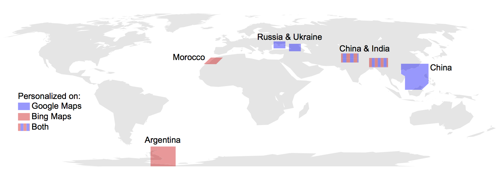
Between Google and Bing Maps, our system was able to detect personalized borders for seven unique geopolitical conflicts. Our baseline set of results consisted of six conflicts. The remaining conflict was a result of continuous tile monitoring: a methodology we use to detect when a map provider updates a border. The figure above shows personalized regions detected by MapWatch. Country names denote where users are shown the personalized tiles.
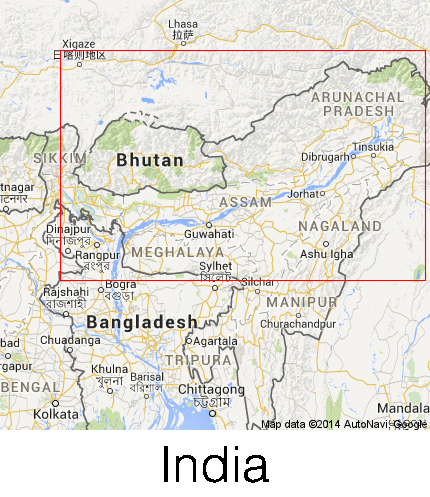
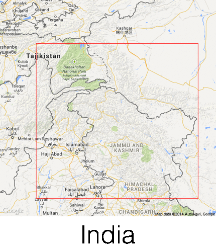
Sino-Indian Border Conflict
The Sino-Indian War in 1962, fought between China and India, resulted from border disputes in the Aksai Chin and Arunachal Pradesh regions. To this day there is no division of territory that appeases all sides. Pakistan also claims territory in the area around the Northwest region of Kashmir. Laws in both India and China mandate that maps display their respective territorial claims, and thus both Google and Bing Maps personalize the borders for users in these two countries. The figures above display the respective personalized borders around Arunachal Pradesh on Google and Bing Maps.
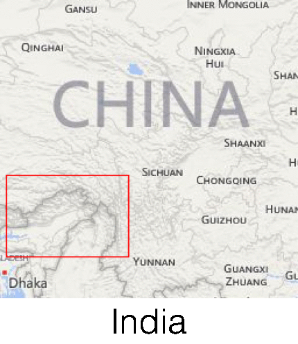
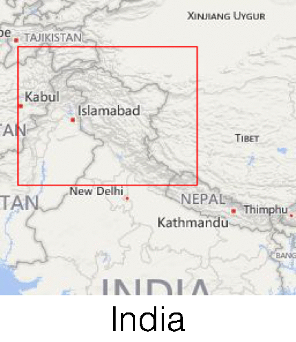
Indo-Pakistani Border Conflict
The Indo-Pakistani War in 1947 was the first time India and Pakistan fought over territorial control of the Kashmir region. Since 1947, the two sides have fought several other wars over the same land. Despite diplomatic attempts to resolve the issue, an agreement never materialized as China did not accept the terms after the Sino-Indian War. Figure 4 shows the personalized borders around the Aksai Chin region.
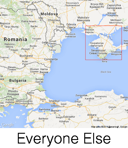
Crimea Annexation
In March 2014, in the aftermath of the Ukranian revolution, Russia secretly invaded and annexed Crimea. At the end of March 2014, the UN passed a general assembly resolution stating the invalidity of the annexation and asking all international organizations and agencies not to recognize Crimea as a part of Russia. However, as of April 2014, the localized Russian Google Maps view includes Crimea within its borders. As shown in the figure above, Russians see a solid border indicating that Russia has sovereignty over the peninsula, while Ukrainians see no border. The rest of the world sees a dashed border indicating that control over Crimea is disputed.
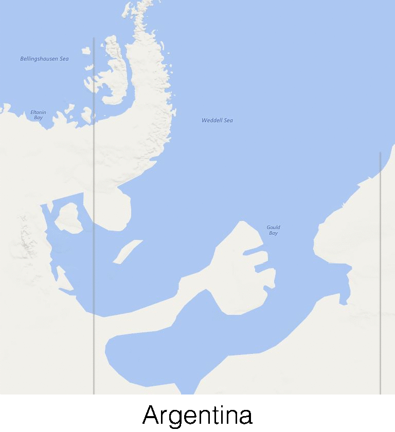
Argentine Antarctica
In 1904, Argentina became the first country to set up permanent occupation in Antarctica. The Argentinian government claimed land between the 25 and 74 West meridians and between the 60 and 90 South parallels. The United Kingdom and Chile also lay claim to parts of this territory. Due to the Antarctic Treaty System signed by each of these countries, to date, no military conflict exists. The treaty emphasized the preservation of Antarctica for scientific research. The figure above shows the border along the longitudinal lines in Antarctica claimed by Argentina. Interestingly, these borders appear only to Argentinian users on Bing Maps; other countries do not see them. Google Maps does not display these borders at all.
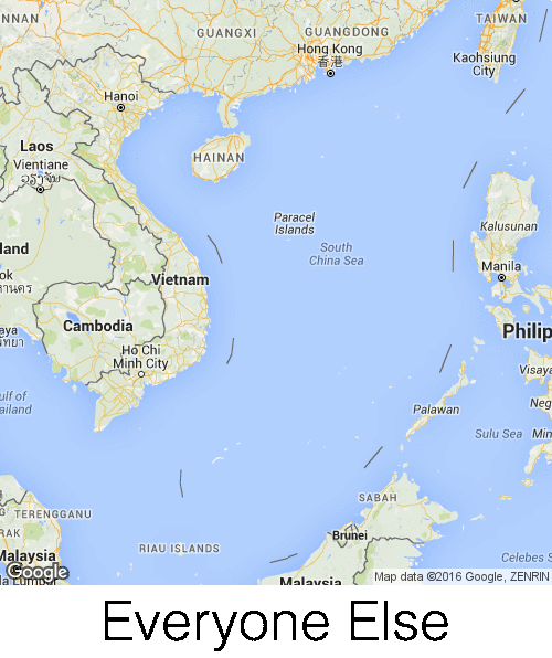
South China Sea
In 1940, the Chinese government released a map displaying the original nine-dashed line. The nine-dashed line marks a border around the edge of the South China Sea labelling this as Chinese territory. This conflicts with the claims of other nations in the area, including Malaysia and Vietnam. In June 2014, China extended the line to the east of Taiwan, and it is now referred to as the ten-dashed line. The figure above shows the South China Sea as seen by Chinese users of Google Maps and to users in the rest of the world. We do not observe any personalization on Bing Maps in the South China Sea.
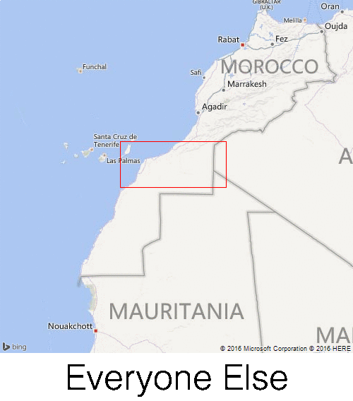
Western Sahara Conflict
The Moroccan/Western Sahara conflict dates back to the 1800’s when Spain first colonized Western Sahara. The conflict escalated in 1973 with the formation of the Sahrawi rebel movement. In subsequent years, Morocco built the Moroccan Wall, a.k.a. the berm, as a strategic maneuver to gain control of Western Sahara. For most users, both Bing and Google Maps display a dashed border separating Morocco and Western Sahara, indicating a dispute. For Moroccan users, however, Bing Maps does not display the dashed border (as shown in the figure above), suggesting that Morocco controls the territory.
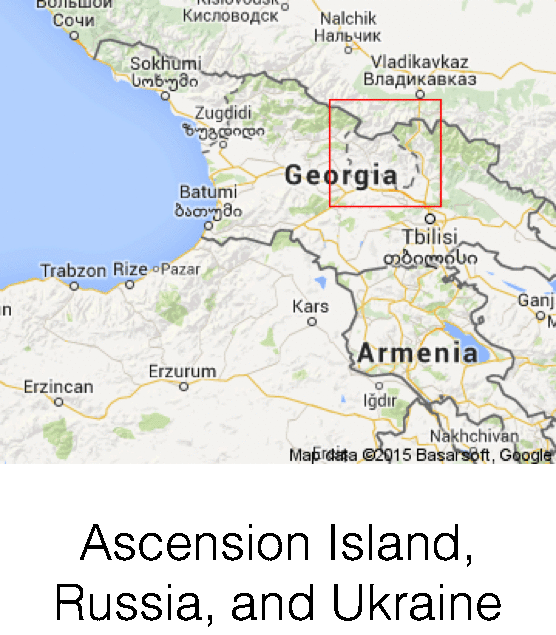
Russo-Georgian War
Over the nine months of MapWatch’s activity, crowdworkers identified one significant, personalized change to international borders: a personalized border inside Georgia around South Ossetia (see the figure above). In the Spring of 2008, relations between Georgia and Russia worsened and led to a 5-day war [34] in the Transcaucasia region. Russia backed the Republics of Abkhazia and South Ossetia because of their strategic location relative to the Black Sea and their natural resources. In March 2015, an “alliance and integration” treaty was signed by Russia and South Ossetia, however this agreement is not internationally recognized. Google Maps updated the Georgia border in May of 2015. The map tile containing this border previously displayed the border dispute between Russia and Georgia in Abkhazia; the 2015 update added a border around the disputed territory in South Ossetia. This border only appears to users who view the Ascension Island, Russia, and the Ukraine localized versions of Google Maps.